Mt. Whitney & Mt. Langley Microadventure route.
Day 1: 3 miles - 3,500' climb.
After an early start I arrived at the ranger station in time to get a 'walk-in' permit for the North Fork Lone Pine Creek, also known as the Mountaineers Route up Mt. Whitney. By the time I reached Whitney Portal it was already 2:00 pm, which left just enough time to hike up to Upper Boy Scout Lake at 11,400' and camp for the night.
 |
| Whitney Portal trailhead |
 |
| 16.5 lbs with food and gear for 2 1/2 days. |
 |
| Leaving the Whitney main trail for the Mountaineers Route. |
 |
| Waterfall crossing. |
 |
| The 'E-Ledges' |
Local wildlife.
Frozen waterafalls and alpenglow on Thor Peak
Day 2: 9.5 miles - 4,600'+ / 4,200'-
After camping at Upper Boy Scout Lake I got an early start on the Mountaineers Route to Mt. Whitney. The use trails were easy to follow to Iceberg Lake, but from there the route climbs a 1,500' chute with loose talus and steep ledges to 'The Notch'. The 'Final 400' is a fun class III climb that leads to the peak and before long I was enjoying the view from the top of Mt. Whitney @ 14,500'.
It was only 1:00 pm so after taking a few photos I took the Whitney Trail down toward Discovery Pinnacle where I left the trail and followed a cross country route down the 'Sand Hill' to Crabtree Lakes, then over Crabtree Pass and finally to Sky Blue Lake just after dark.
Morning on Upper Boy Scout Lake @ 11,320'
Looking straight up The Chute from Iceberg Lake @ 12,640'.
The beginning of the talus climb up The Chute.
The view back down to Iceberg Lake from The Chute.
Complex terrain in The Chute.
The view from The Chute.
Almost there!
Finally at the top of The Chute, the view from The Notch.
Looking straight up the Final 400.
Whoa! That steep. Looking straight back down from near the top of The Chute.
The view from the top of the Final 400.
Happy camper.
The view from the top of Mt. Whitney.
Mt. Whitney @ 14,500'
Mt. Whitney.
Panoramic view toward Guitar Lake from the Whitney trail.
Panoramic view toward Guitar Lake from the Whitney trail.
Trail Crest at 13,600'
The view of Mt. Langley to the south from near Discovery Pinnacle.
Getting near dark just above Sky Blue Lake in Miter Basin.
Day 3: 16 miles - 3,600'+ / 6,700'-
After a windy night near the shore of Sky Blue Lake I arose to crystal clear skies and enjoyed a relaxing hike through Miter Basin. After refilling with water at Upper Soldier Lake I started the sandy scree slog up up up to Mt. Langley. There are large cairns setup by the park service to lead the way and after a few hours I was on top, looking back at Mt. Whitney where I had been at the same time the day before!
The rest of the day was all down hill through the beautiful golden meadows in the Cottonwood Lakes area. I made it back to the car at Horseshoes Meadows by 6;00 pm, making it a 52 hour Microadventure.
The fall colors and shorter days reminded me that it was the end of the season and soon the first winter storms would arrive. This was a great way to end another summer in the High Sierra.
Easy cross country travel in Miter Basin.
Morning on Three Tree Lake.
The route to Mt. Langley goes straight up that sand hill.
Looking back toward Upper Soldier Lake on the climb to Mt. Langley.
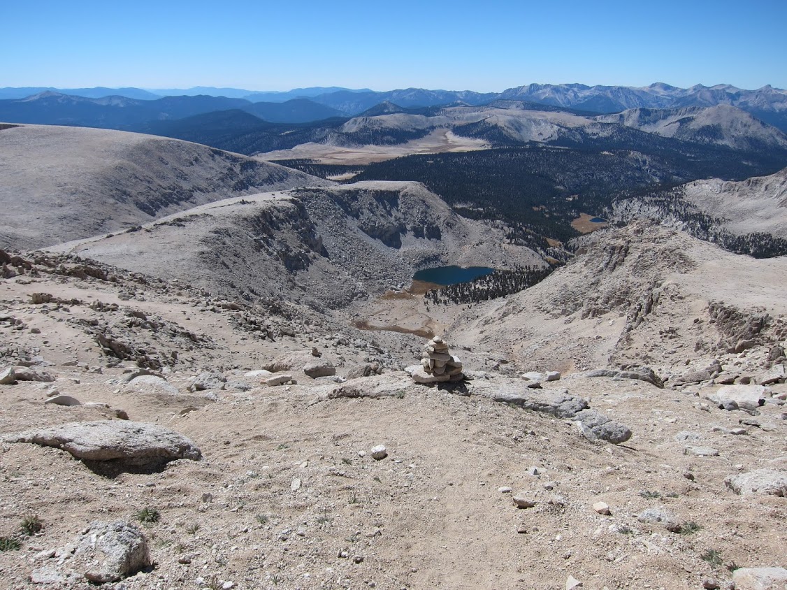
Please don't move the cairns:)
I don't think anyone will be moving these huge cairns!
The one class III section on the way to Mt. Langley.
Cairns lead the way through the maze of sandy scree.
Getting higher, the view back toward Upper Soldier Lake.
Finally at the top. The view of Mt. Whitney from Mt. Langley.
The view of Mt. Whitney and Sky Blue Lake from Mt. Langley.
The view of Mt. Whitney from Mt. Langley.
Two 14'ers in 24 hours.
Mt. Langley, 14,042'.
The view from the top of Old Army Pass, the route down to the Cottonwood Lakes.
Golden meadows in the Cottonwood Lakes basin.
I was up there a few hours ago! The view of Mt. Langley from the Cottonwood Lakes.
Back to the car by 6:00 pm. 23 hours of hiking over a 52 hour Microadventure.
~ Thanks for reading ~
A gear list from this trip:
| 


I am doing the JMT and finishing late September to horseshoe meadow. I was going to camp at Soldier Lake and go around to Army Pass to climb Mt. Langley. Would it be better to go straight up to Langley like you did? I will have a bigger load than you.
ReplyDeleteVery nice article. The pictures bring back old memories. Thank you.
ReplyDelete